


Curled up in my sleeping bag, I poke my head out just far enough to watch the mist roll off the water and drift upward from the lakeshore through red-and-gold leaves. I’m glad the next stretch of trail has bridges to see me over swollen bogs and fast-running streams—they’ll make crossings a little easier—but I’m not ready to crawl out of this lean-to just yet. A loon’s call echoes from the other end of West Lake, but I can’t spot the bird among the rain-made ripples. Backpacking in the rain isn’t my favorite, but as I listen to drops plop into the lake 20 feet away, I can’t help but think I’m in a good place to enjoy it. What’s the rush to leave? These mountains have drawn me in, and there’s no better place to surrender to their pull than this 20.2-mile weekend hike.
Turn by Turn From the Pillsbury Mountain Trailhead
1) Head north along the French Louie Trail.
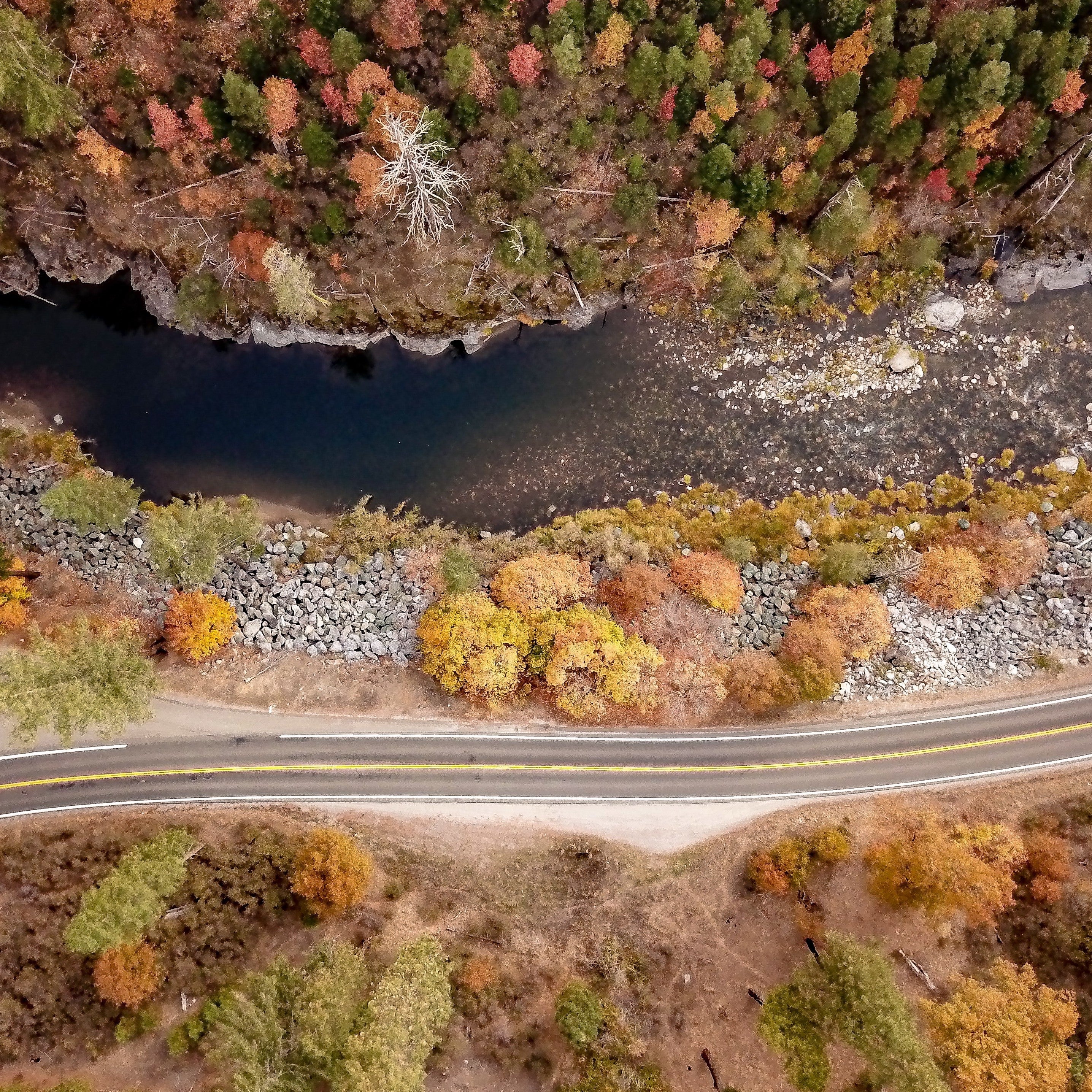
2) At mile 1.6, continue straight toward Cedar Lakes, crossing boardwalks through a marshy lowland.
3) Intersect the Northville-Lake Placid Trail at mile 4.2, just beyond a wooden bridge below the Cedar Lakes Dam. Turn left (southwest) on the blue-blazed NPT, passing a clearing a quarter-mile later where you can sometimes spot wild turkeys.
4) Cross the outlet between Cedar Lakes to the left and Beaver Pond to the right on a wooden footbridge. Immediately after the bridge (mile 5.1), a .4-mile side trail on the left leads to the Beaver Pond Lean-to.
5) Climb gently up and over Cobble Hill (too small to provide any views) and cross a collection of streams and wetlands, passing Mud Lake and intersecting the Mud Lake Trail in a clearing at mile 10.8. A tenth of a mile later, look for a cairn and trail right to West Lake #1 Lean-to.
6) Next day, pass through stands of white birches and green balsam firs before crossing the long bridge over the outlet of South Lake at mile 11.3, with panoramic views down the entire 1-mile length of the water. Cross another smaller bridge, then head straight (east) at an intersection (mile 11.9), back onto the French Louie Trail.
7) Follow the French Louie Trail past side trails to Sampson Lake (.3 mile out and back) and Whitney Lake (2.3 miles round-trip). Hug the shoreline of skinny Pillsbury Lake, then turn right at mile 18.6 and descend back to the trailhead at mile 20.2.
Campsite: Beaver Pond Lean-to (Mile 5.5)
Despite its name, this shelter sits on a small rise overlooking the Cedar Lakes among open pines. If you would rather tent, there are a collection of secluded spots on the far side of the bridge, on the west side of the trail. The basic lean-tos along this route can fit up to 8 and are first-come-first-served (as are the tent sites), and many have outhouses (bring your own hand sanitizer). The short approach makes this a good option for a late-start hiking day.
Campsite: West Lake #1 Lean-to (Mile 10.9)
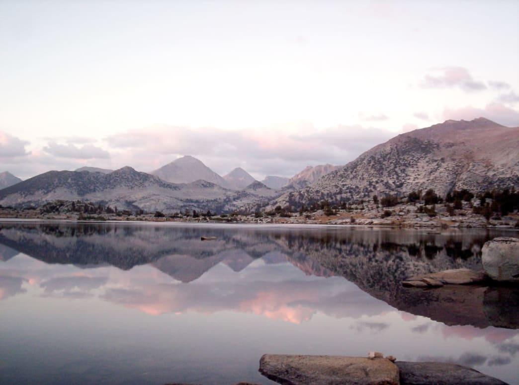
Catch this campsite after a big rain event with the wind rolling from the west, and you can watch the waves from your sleeping bag. This lakefront property comes with views over the fire pit and down the tree-lined and island-specked lake into the remote western end of the West Canada Lake Wilderness Area; in early and mid-October the beeches, maples, and birches of the Adirondacks paint the view in bright red and orange.
French Louie
Circus performer, lumberjack, trapper, and hermit Louie Seymore, or French Louie, called the West Canada Lakes region home in the late 19th century. The clearing just north of the West Lake campsite is home to a burned-out foundation and fireplace which belonged to a former ranger’s cabin, but off to the side are the older-looking remains of another fireplace built by French Louie. His cabin once stood nearby, and he built this fireplace to anchor a separate cabin for guests, though it never got further than the stone column. Twice every year, Louie would emerge from the woods with a stash of pelts and furs, and, as the story goes, announce his arrival to town with a chorus of animal howls and cries from atop a nearby hill.
Do It
Trailhead 43.5880, -74.4860; 10 miles northwest of Speculator, NY off Military Road
Season May to October
Permit None
Distance 20.2 miles (lollipop loop)
Time 3 days
Difficulty 3/5

Leave a comment
This site is protected by hCaptcha and the hCaptcha Privacy Policy and Terms of Service apply.